The RIS index is a list of location codes (ISRS) with additional information about the objects, such as characteristics (name, fairway, ...), limitations (depth, bridge clearance, transmission line, ...), working hours...
Software for visualizing electronic maps, can be downloaded from the website 7Cs(www.sevencs.com) If you have any suggestions or comments about actual charts, please send to e-mail: stoyanov@appd-bg.org
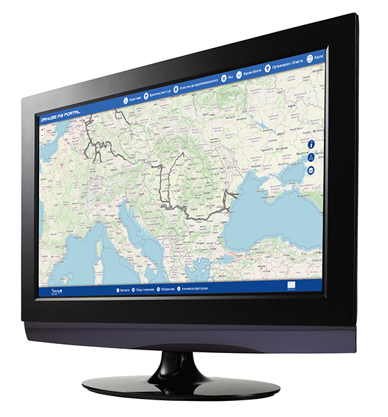
The FIS portal is the main information portal for the users of the waterway of the Danube river regarding fairway information. The portal provides up-to-date information on water levels, critical sections, ice phenomena, as well as notifications to ship owners. In addition, information on various water object on the river (bridges, locks, ports), contacts of responsible institutions, as well as electronic and paper navigation maps can be found on it. The FIS portal is available at the web address: www.danubeportal.com and is available in English, German, Slovak, Hungarian, Croatian, Serbian, Romanian and Bulgarian.